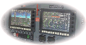
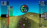
Terrain elevation data for G3 EFIS systems
On this page you can download both low and high resolution terrain elevation data for MGL Avionics iEFIS G3 systems.
These systems support a new format introduced in April 2014 which includes high resolution data.
The files come in two versions”
A) A single file containing low resolution (approximately 900 meters x 900 meters grid) that covers the entire Globe including polar regions.
B) A set of 8 high resolution terrain elevation files, each covering the area W180 to E180 for a 15 degree height of latitude in the region from N60 to S60 degrees.
These are the files that are pre-installed by the factory onto G3 systems. They are available here for purposes of system rebuilds. These files should be unzipped and the resulting files copied to your EFIS “Terrain” folder.
Note: You are downloading ZIP files, each contains a single file with a “*.DAT” file extension. You must extract the DAT file from the ZIP file for use by the EFIS.
Terrain Low resolution (Entire globe)
Note: You MUST install at least the above low resolution terrain file for the high resolution files below to be able to work in your system. You may install ONLY the low resolution file if you have no interest in the high resolution data.
Terrain high resolution North 60 to 45 degrees
Terrain high resolution North 45 to 30 degrees
Terrain high resolution North 30 to 15 degrees
Terrain high resolution North 15 to 0 degrees
Terrain high resolution South 0 to 15 degrees
Terrain high resolution South 15 to 30 degrees
Terrain high resolution South 30 to 45 degrees
Terrain high resolution South 45 to 60 degrees
U.S. Users would need N60-45 to N45-30 and N30-15
RSA Users would need S15-S30 and S30-S45
The Total size of ALL of the above data is about 2.2GBytes (download size) and about 2.6GBytes once unzipped.
Data sources:
Data is based on a blending of the USGS survey based terrain data collection (known as “DEM” files) with Space Shuttle terrain radar data for the higher resolution data. Space Shuttle data covers the area from N60 to S60 due to orbit restrictions. The Space Shuttle data contains some omissions which partly are intentional (sensitive areas) and partly are based on shadow effects and related technical issues. Some of the data has been corrected by means of referring to survey data.
Disclaimer:
This data must not be used as sole base of navigation. You must refer to official sources and aeronautical charts and observe MOA altitudes when flying IFR. This data is not a substitute for official sources and must be used with care. Absolute accuracy is not guaranteed in any way.
NEVER use terrain data to fly your aircraft close to indicated terrain in IFR or VFR conditions. Doing so is reckless and stupid.